People who love adventure and challenges often find their way to Everest Base camp as it is a perfect destination for people looking for life-changing experiences. Everest Base camp trek has often been awarded as the best long-distance trek in the world. The trek forms along the side of Dudh Koshi River valley, the lifeline of the villages along the way.
One can find the best tracks and beautiful bases for trekking and camping in Everest Base camp giving you once in a lifetime experience.
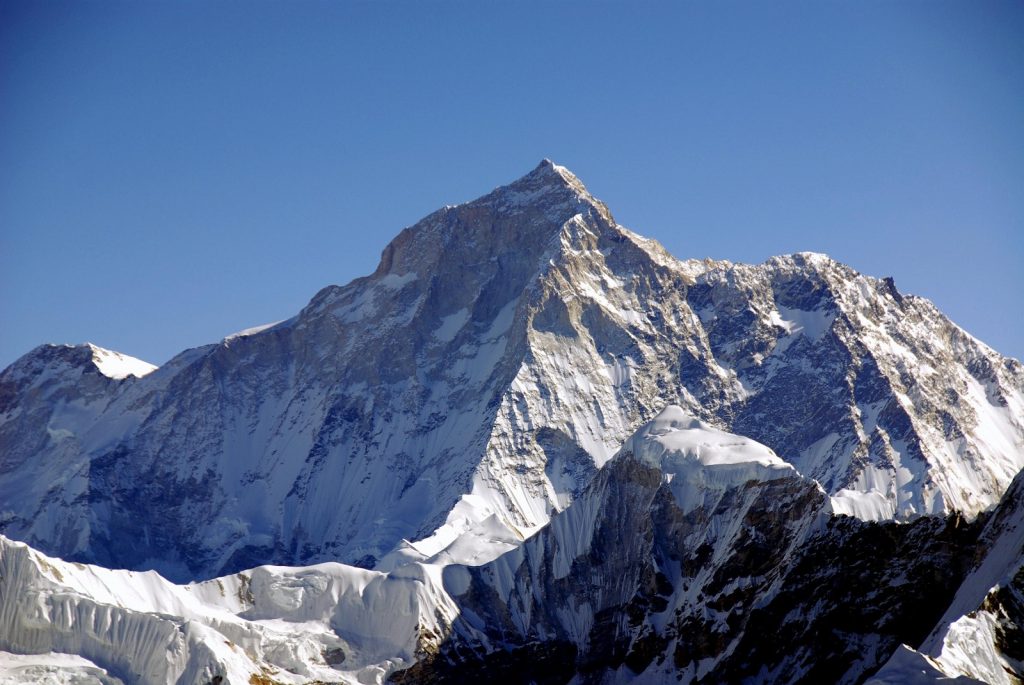
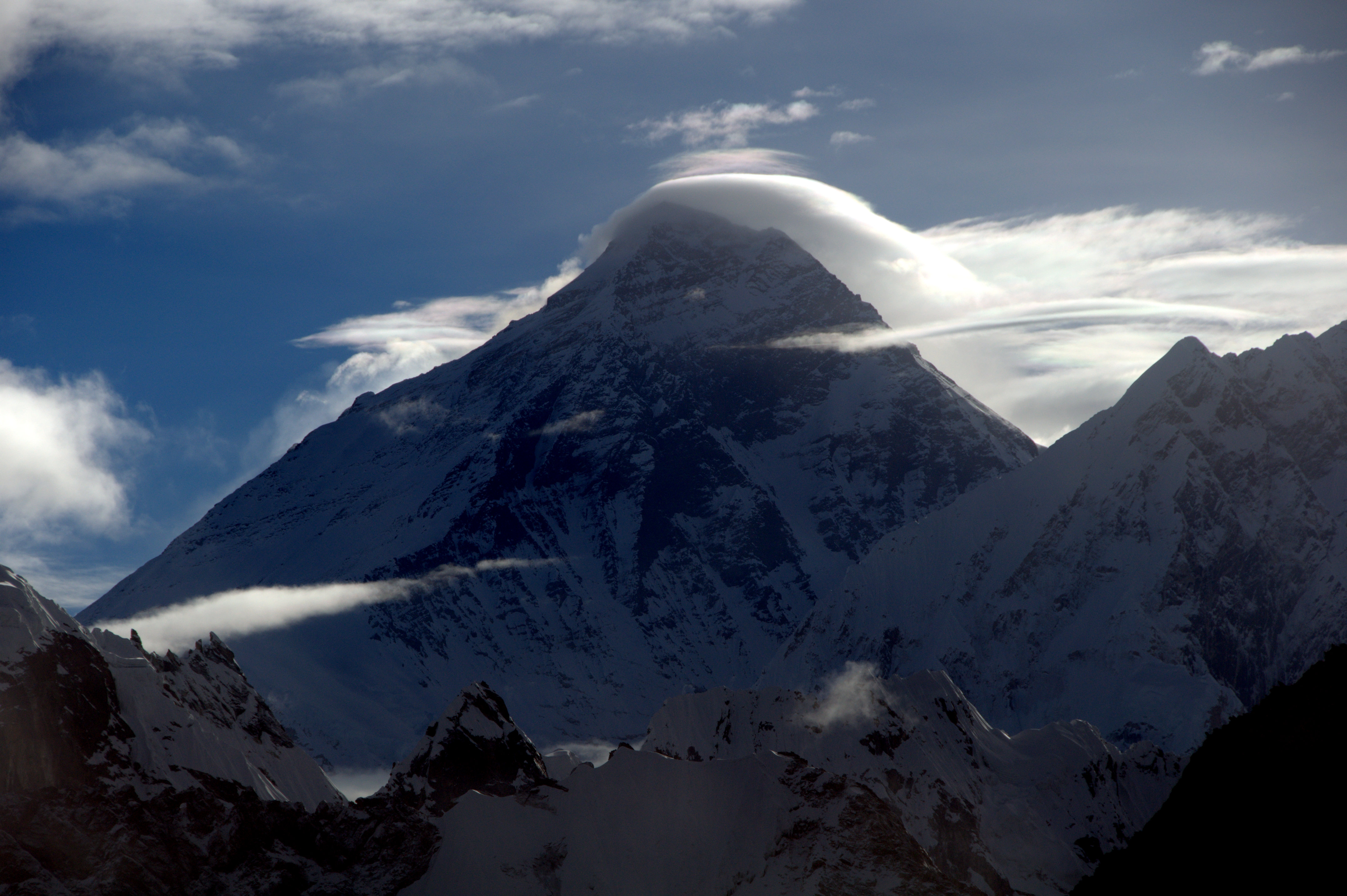
Nepal a multiethnic nation is formed mostly by the mighty Himalayas. It is the birthplace of Lord Buddha and the home to the world’s tallest mountain Mount Everest which is locally known as Sagarmatha. After the successful expedition of Tenzing Norgay and Edmund Hillary in 1953, the route has been every trekker’s dream.
Every year more than 50000 people from around the world come here to walk the trek. The trekking first starts from the Lukla village, a small remote village which is the starting and the ending point of the Everest Base camp. This village provides large varieties of shops where one can find all the basic equipment and essentials. Western style meals are also available with internet facilities. It is basically a place where you can pick up any last minute items and prepare yourself for the journey ahead.
Lukla to Phakding trek starts with gradual descent till Phakding via Chheplung and Ghat villages. Mani stone wall carved with prayers appears to not just be beautiful but also gives information about the life and culture of the local people. This route from Lukla to Phakding gives a view of Dudh Koshi River below and surrounded by rhododendron forest which truly feels like walking towards heaven.
Lukla to Phakding trek distance 6.2 kilometers, weather elevation 2610 meters above sea level. Pakding is situated lower than Lukla minimizing the altitude sickness. Lukla to Phakding is about 3 hours walking distance but completely depends upon the walking speed and fitness level. Walking trail is easy as it is slightly downhill then all the way flat along the Dudhkoshi River. Phakding is a small and beautiful village located in the Khumbu region of Nepal. The main occupation of the people belonging to this area is tourism.
After Phakding the next stop is the famous Namche Bazaar. Walking duration from Phakding to Namche Bazaar is 5 to 6 hours to cross the 830 meters elevation. The uphill walk to reach Namche bazaar begins from Larja dobhan. The trek contains amazing natural scenery with high mountains. There are many tea stops along the route Monjo, Toktok, Jorsalle, etc are some of the famous ones. Monjo acts as an entrance to the famous Sagarmatha National Park where forms are needed to be filled up and a ticket must be bought which is later needed while entering the next stop Namche Bazaar. Before reaching Namche Bazaar few suspension bridges are to be crossed.
Namche Bazaar is the most important town in the Khumbu region which is also known as “the land of the Sherpa people”. Every morning a market takes place in the town center; all the basic essentials are found in the bazaar. Apart from tourist and locals, you will also get to see the continual traffic of yaks, guide, and porters.
Leaving Namche Bazaar along the trail of Imja Khola valley breathtaking view of Thamserku, Kangtega and Aman Dablam mountains can be seen. Tengboche the next stop is the most common night halt after Namche Bazaar. The distance from Namche Bazaar to Tengboche is 9.2 kilometers. The elevation is 3870 meters 12700 feet above sea level. In its center lies the Tengboche monastery which is the biggest in the Khumbu region and also the highest monastery in the world. It is one of the best viewpoints of Mt. Everest and Lhotse wall on the entire hike to Everest Base camp. As you climb up the density of the trees will start to thin. Buddhist stupas can also be seen here. Distance from Namche Bazaar to Tengboche trek distance is about 5 to 6 hours walk.
Following the trail along the Imja Khola, Dingboche is reached. Traditional Sherpa settlements, Mani stones, Yak and wildlife pastures are the main features of Tengboche to Dingboche hiking route. Along with this trail, small tea houses are found. Dingboche is also a good place to halt and end the day’s trek.
After 6 to 7 hours of a trek from there, we then reach Lobuche. The elevation of Lobuche village is 4910 meters/ 16109 feet above sea level. This point of the trek will mark you close to Everest Base camp. From here you can see the whole of Khumbu glacier. You will also find many prayer flags for many brave mountaineers.
After 4hrs of a hike from Lobuche, the last settlement is reached which is known as Gorakshep village it is the last village close to Everest Base camp. The distance from Lobuche to Gorakshep village is 4.7 kilometers. The walk can get tough here as here the air is very thin and also because of the high altitude. Water can freeze anytime at this altitude. Nights can sometimes be very cold here. Chances of shortness of breath, dizziness or even awful headaches are possible but the beauty of the scene makes everything worth it.
1.2 kilometers from Gorakshep you will reach Kalapatthar. The elevation of Kala Patthar is 5550 meters/ 18208 feet above sea level. The breathtaking beauty of the Khumbu region gives complete pleasure that stays as a beautiful memory forever.
Hike to Kala Patthar in the early morning is highly recommended for the sunrise view. Kala Patthar also brings you face to face with the majestic Mount Everest. Standing on Kala Patthar you will have a panorama view of all the beautiful mountains and Khumbu glacier. Which is why this makes people find Heaven on earth. This marks the end of Everest Base camp trek.
All the people who have had this trekking experience has found it to be their life-changing experience and many have also come back for more because here “perfect happiness is not just in the destiny but is in the journey as well”.
Tripnexts a name given to our one of the online booking travel and tour company in Kalimpong. A company formed by “Phurba Sherpa” with over many tested and finalized experience, we specialized in providing the best quality tour services for our travel junkies.